CROFT
Client
San Juan, PR
Location
1908
Year Built
1,000
Square Feet
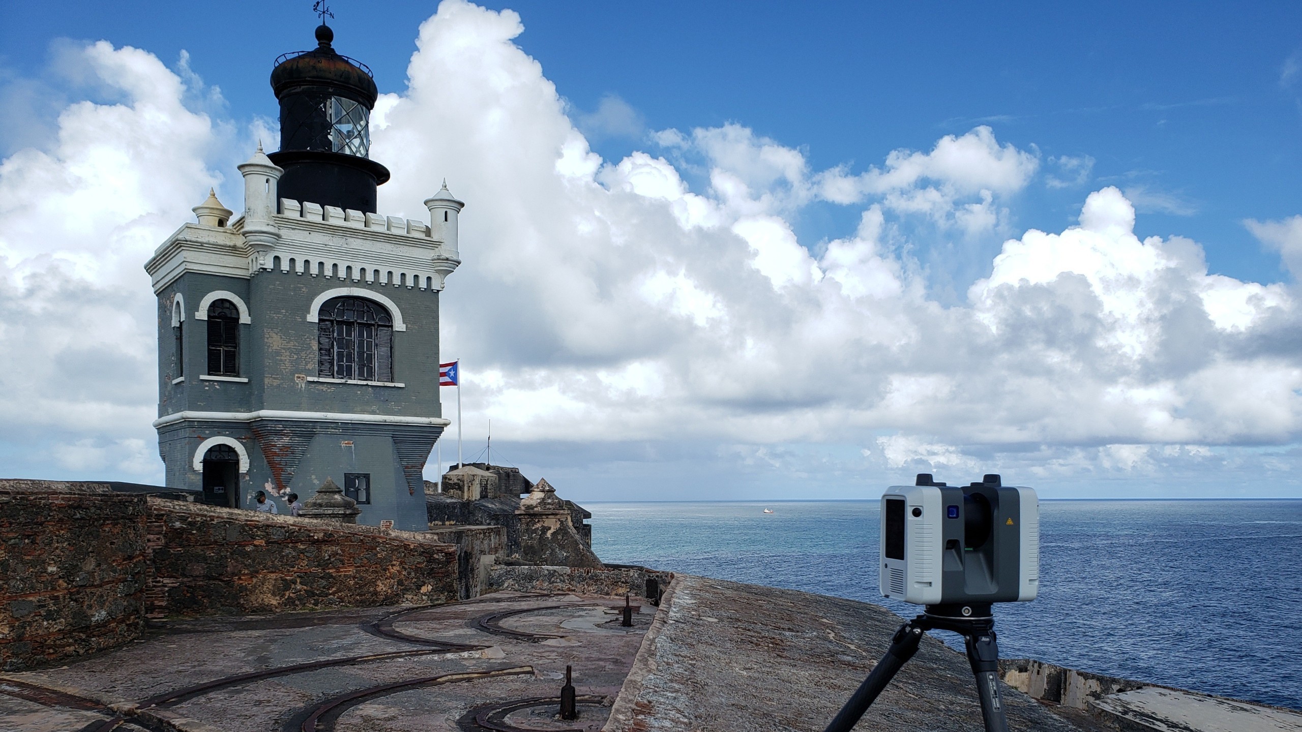
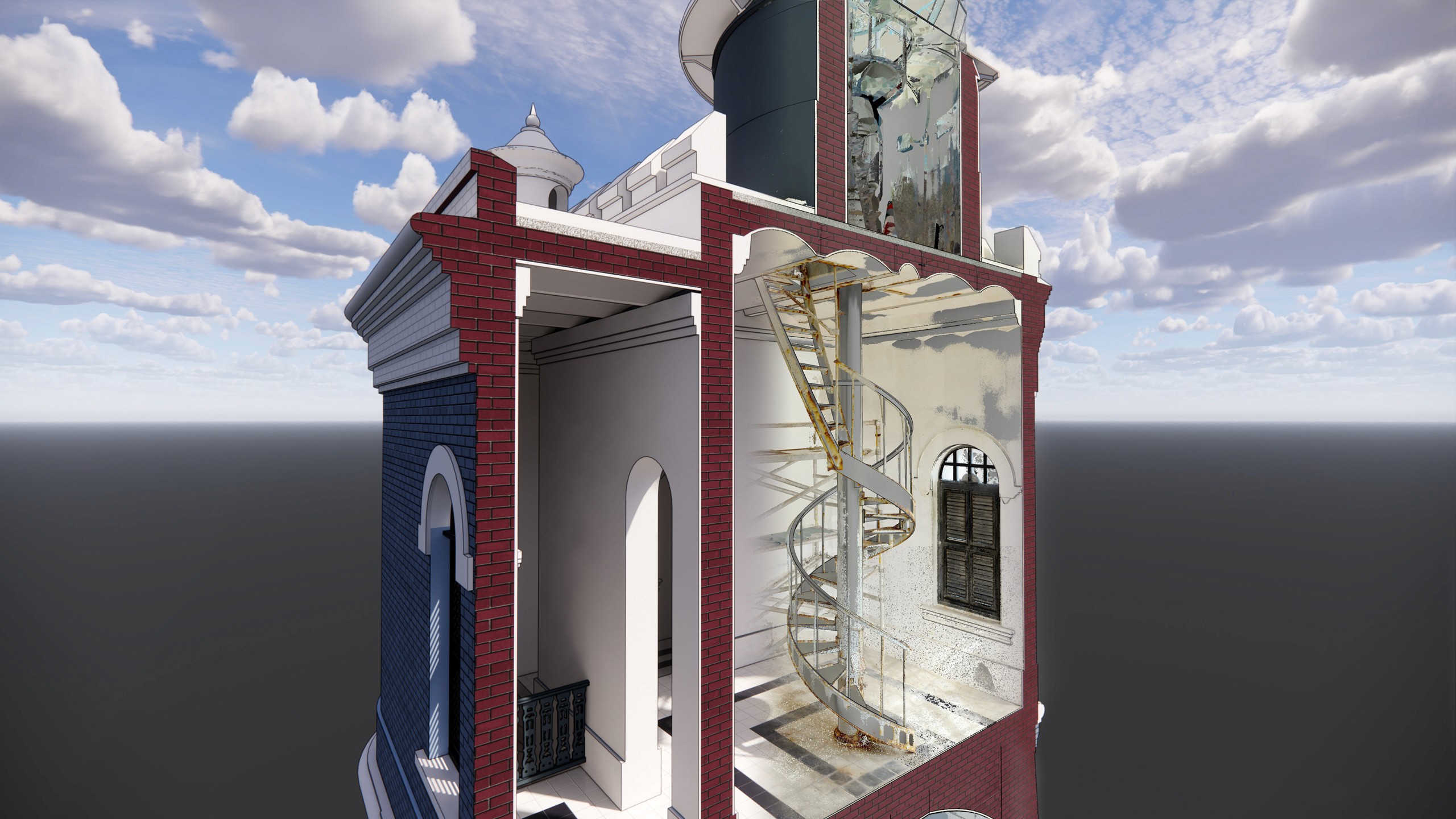
At just 1,000 square feet, the El Morro Lighthouse presented the highest complexity per square foot RC Monkeys has ever documented. The Moorish Revival masonry tower sits atop Castillo San Felipe del Morro, a 16th-century fortress rising 140 feet above the Atlantic and part of the San Juan National Historic Site, a UNESCO World Heritage Site. Decades of exposure to the marine environment accelerated the deterioration of the masonry structure, cupola, and interior spiral stair. CROFT, under an NPS contract, hired RC Monkeys to support the lighthouse's structural restoration by providing laser scanning, photogrammetry, and as-built Revit modeling.
[ SERVICES ]
Laser Scanning
Photogrammetry
Revit Modeling
[ delivered value ]
Existing conditions baseline for structural restoration
Complete coverage, including areas beyond the scanner's line of sight
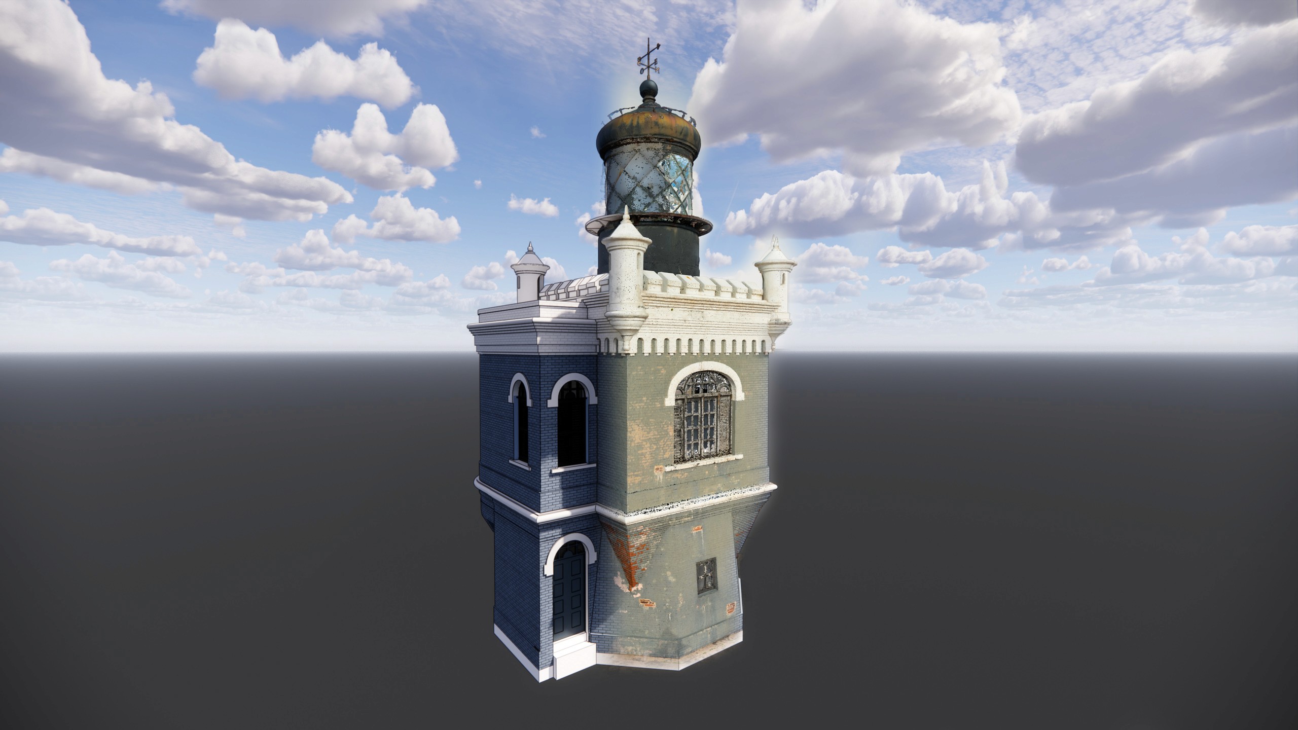
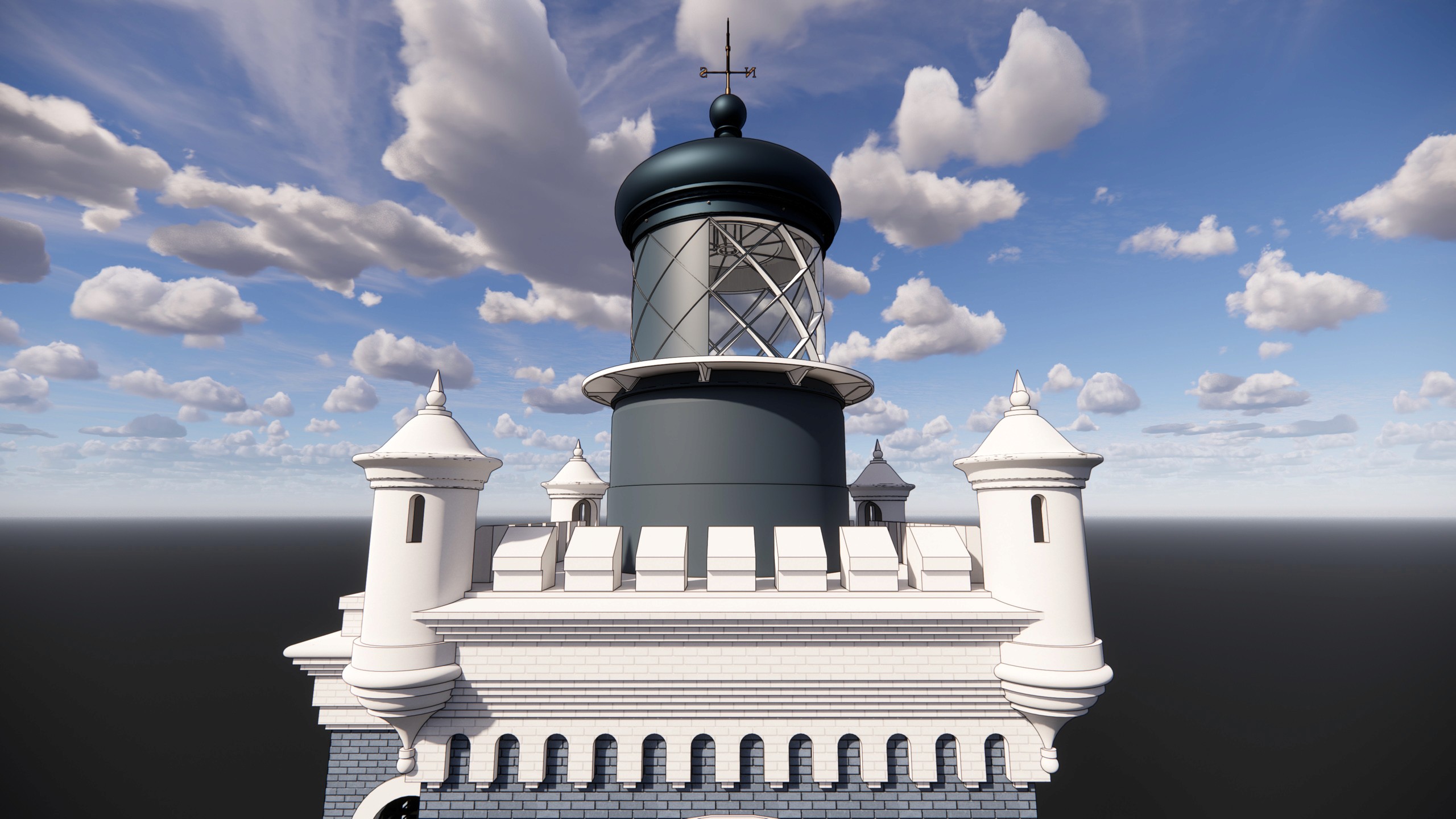
Most components modeled at LOD 300, ±5/8" represented accuracy
Capture assets delivered in 6 days; Revit model 13 days after

[ challenge ]
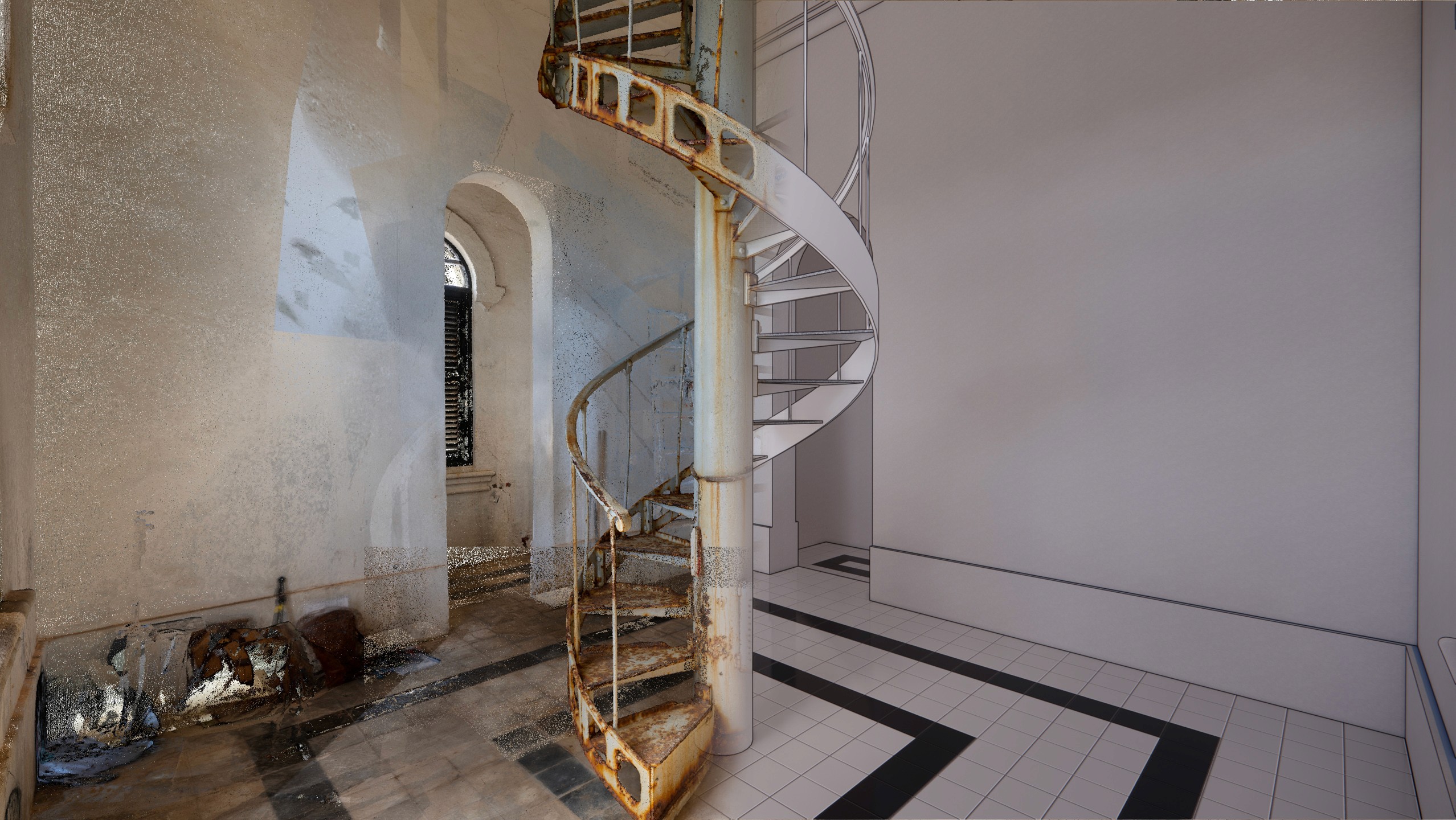
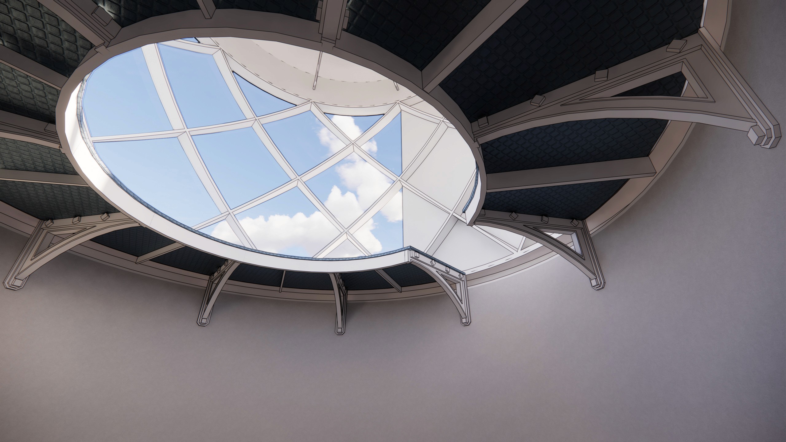
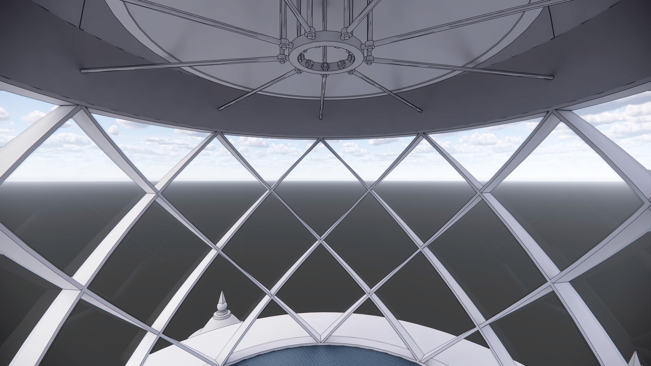
The lighthouse's position atop the fortress, roughly 55 feet above its base, made traditional documentation methods impractical. Even terrestrial laser scanning could not reach the upper portion of the cupola and sections of the north façade due to limited line of sight. Inside, the slanted octagonal base and thick masonry walls complicated both capture and modeling. Record drawings were limited, and the harsh marine environment had accelerated deterioration of the very elements that needed the most precise documentation.
[ SOLUTION ]
The capture strategy had to account for what the scanner alone could not reach.
Terrestrial laser scanning captured most of the structure. For the upper cupola and north façade, RC Monkeys supplemented with aerial photography. These images were processed with the scan data using photogrammetry, producing a complete and accurate photorealistic point cloud of the lighthouse.
Developing the Revit model required careful planning around the slanted octagonal geometry and thick masonry walls. Using scan data, a field investigation report, and the preservation team's notes, RC Monkeys documented most building components at LOD 300 with ±5/8" represented accuracy. Elements that required orthogonal correction for model usability, such as the turrets, were flagged and presented in the final review meeting.
Capture deliverables were completed in 6 business days, including travel. The Revit model was delivered 13 days after.
Explore Photogrammetry Model
Next