Houser Walker
Client
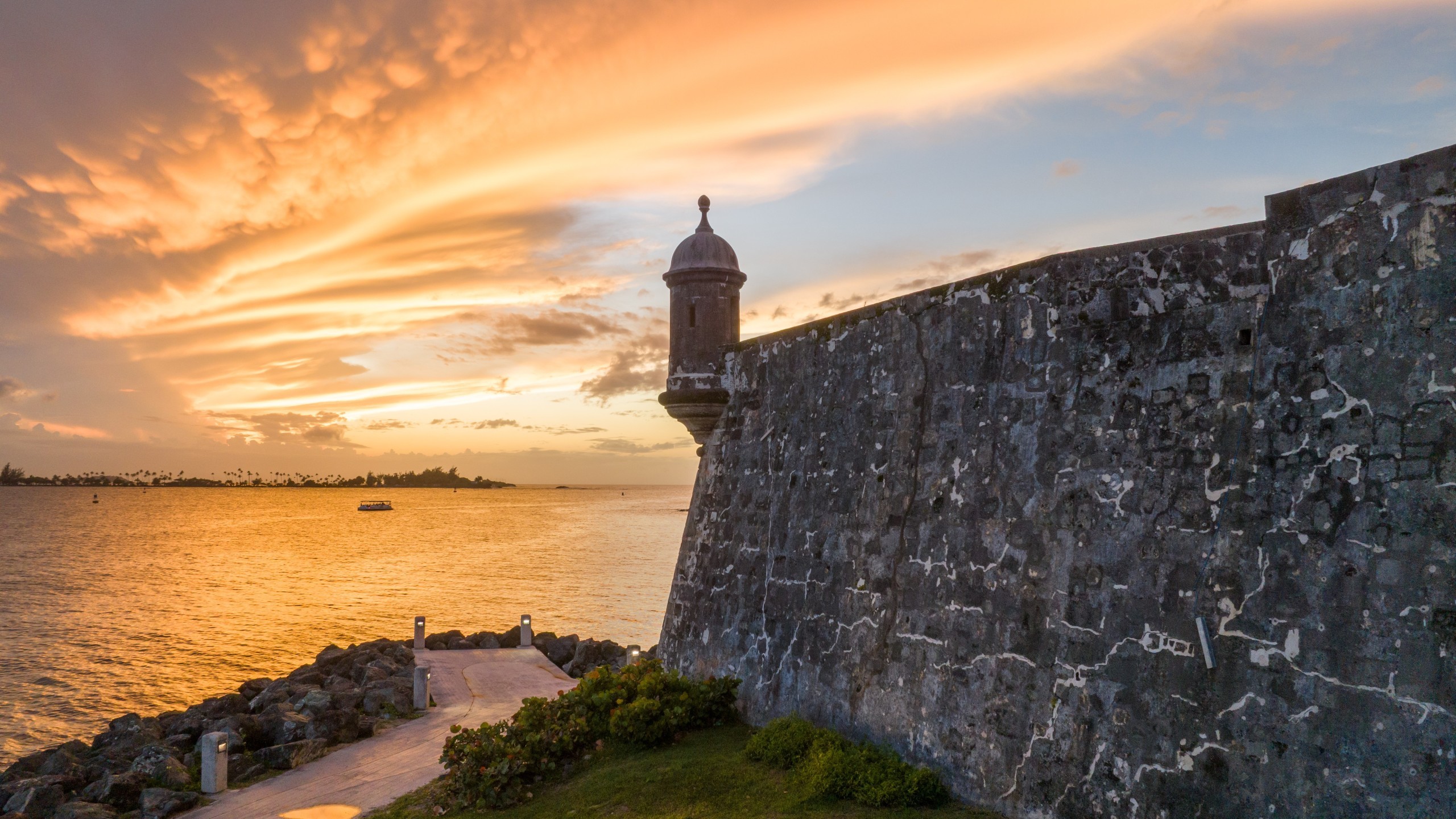
San Juan, PR
Location
16th Century
Year Built
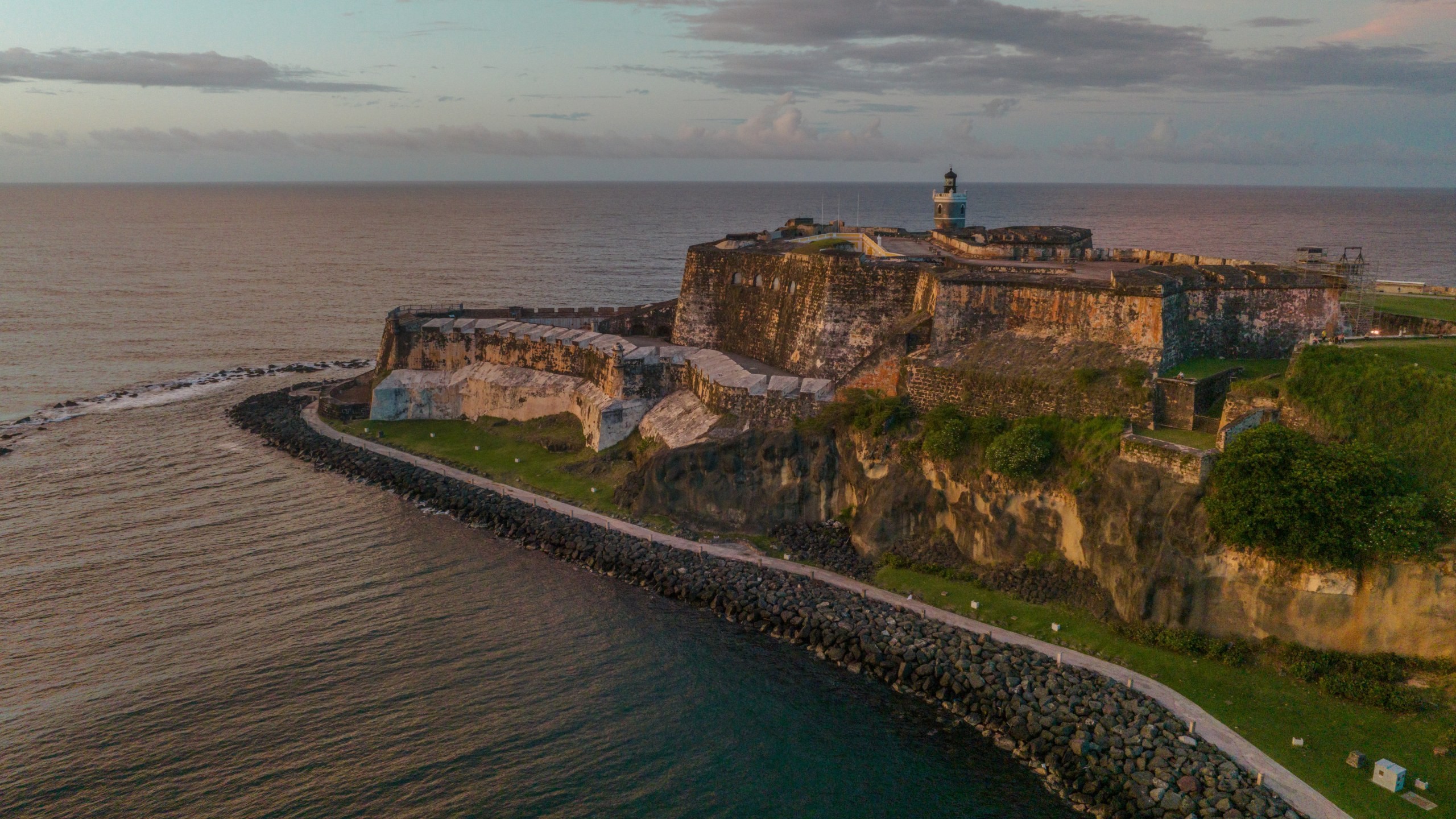
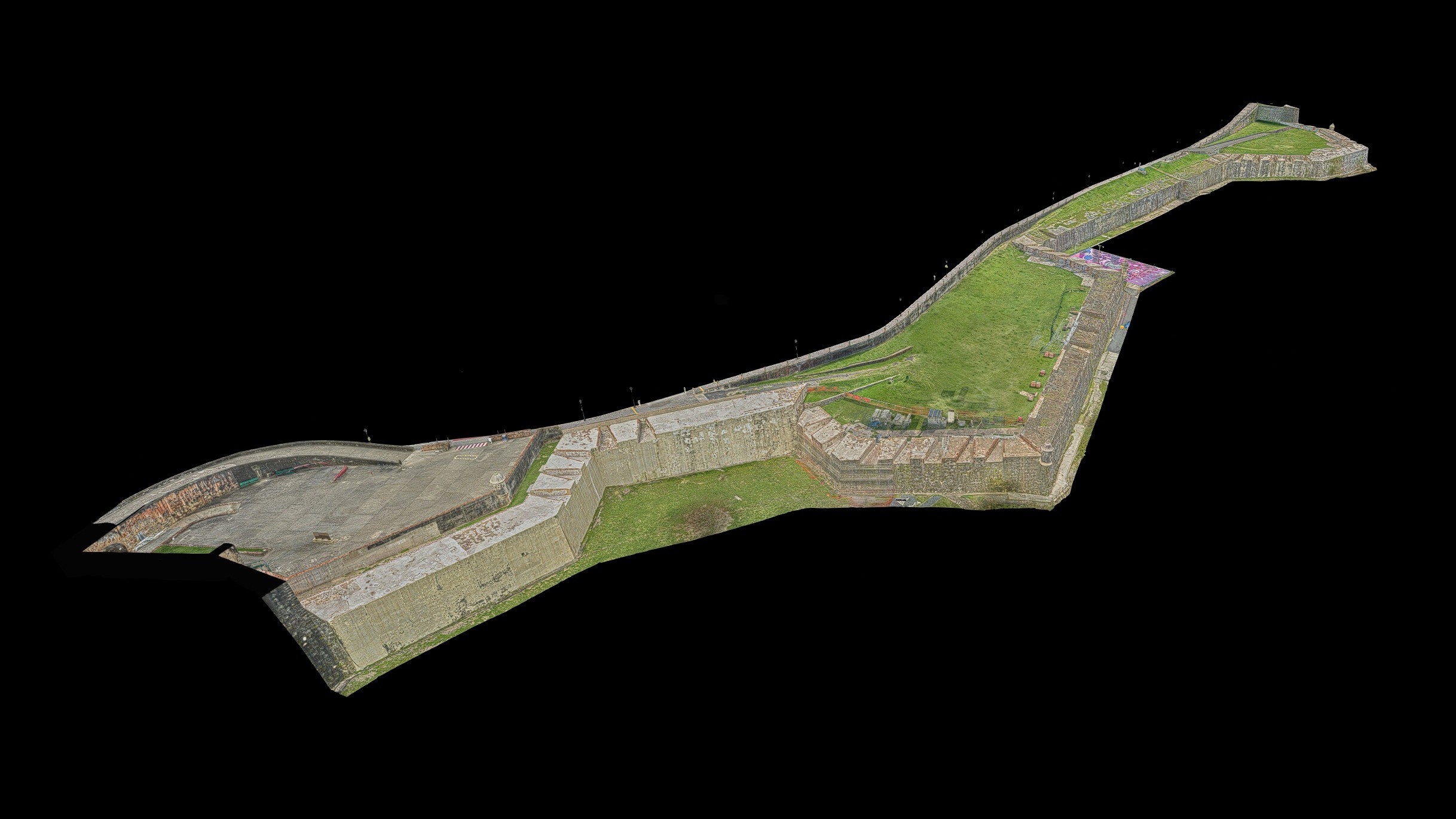
When Houser Walker Architecture needed existing conditions documentation of 1.2 miles of fortification walls at the San Juan National Historic Site, a UNESCO World Heritage Site, RC Monkeys defined an optimal capture approach for a multi-disciplinary project team. The walls, built by the Spanish between the 16th and 20th centuries, have been affected by erosion, storm drain failures, and internal voids. Using terrestrial laser scanning, aerial and ground photography, and photogrammetry, we provided the design team with a shared baseline for a major rehabilitation effort.
[ SERVICES ]
Laser Scanning
Photogrammetry
[ delivered value ]
1.2 miles of fortification walls documented in a single mobilization
Georeferenced inspection photos for remote condition assessment
One dataset serving multi-disciplinary team
Vegetation digitally removed for unobstructed visual assessment
5 days capture, 10 days to delivery


[ challenge ]
Six bastions connected by massive defensive historic walls had to be documented in a single mobilization, while the site remained open to the public. The fortifications’ construction and the site conditions favored manual aerial capture: tall vertical surfaces, deep cannon embrasures, and frequent changes in wall direction made automated flight paths impractical across much of the site. Frequent weather interruptions and access coordination around sensitive adjacent areas added another layer of planning complexity to the project.
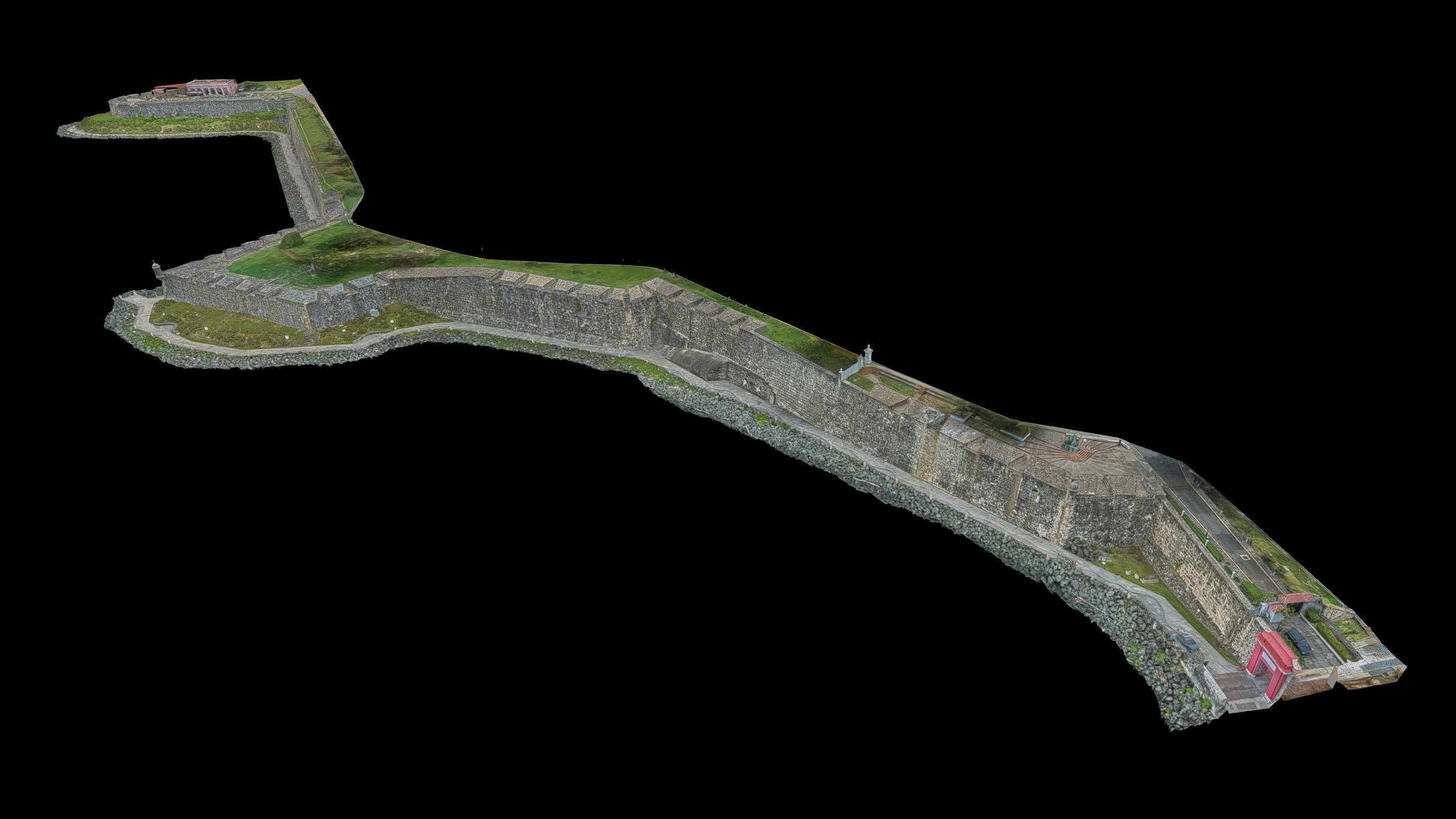
Because multiple teams would rely on the same dataset for different purposes, the documentation had to support visual assessment, dimensional accuracy, coordination, and quantity take-off from day one.
[ SOLUTION ]
The capture strategy had to produce one dataset usable by every downstream team.
RC Monkeys combined terrestrial laser scanning with aerial and ground-level photography to create detailed photogrammetry 3D assets. Because of the project’s scale, all datasets were tied to survey control provided by Martin/Martin, and the final deliverables achieved 1/4” global accuracy with a 1/8” detectable feature size.
75% of the aerial capture was flown manually to navigate the walls' complex geometry, including embrasures, bastions, and directional shifts that automated flight paths could not handle. Over 15,000 photos were captured and processed into photorealistic mesh models and colorized point clouds.
The resulting point clouds gave the design team drawing-ready backgrounds, reducing the need for additional drafting and modeling. The web-hosted model became the project's shared visual reference, allowing team members to inspect wall surfaces, retrieve georeferenced source photos, and download the most useful images for inclusion in reports. To provide cleaner visual access to the wall surfaces, vegetation and existing scaffolding were digitally removed in post-processing.
5 days from mobilization to final scan. 10 days from capture to delivery.
Explore Photogrammetry Model
Next