DHM Design
Client
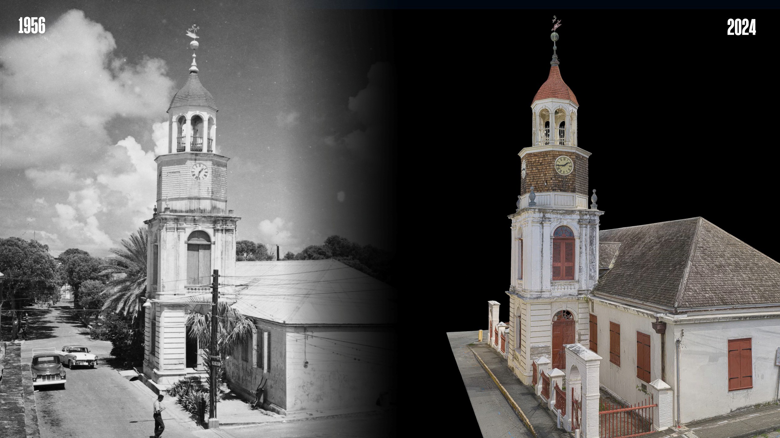
St. Criox, USVI
Location
1753
Year Built
5,500
Square Feet
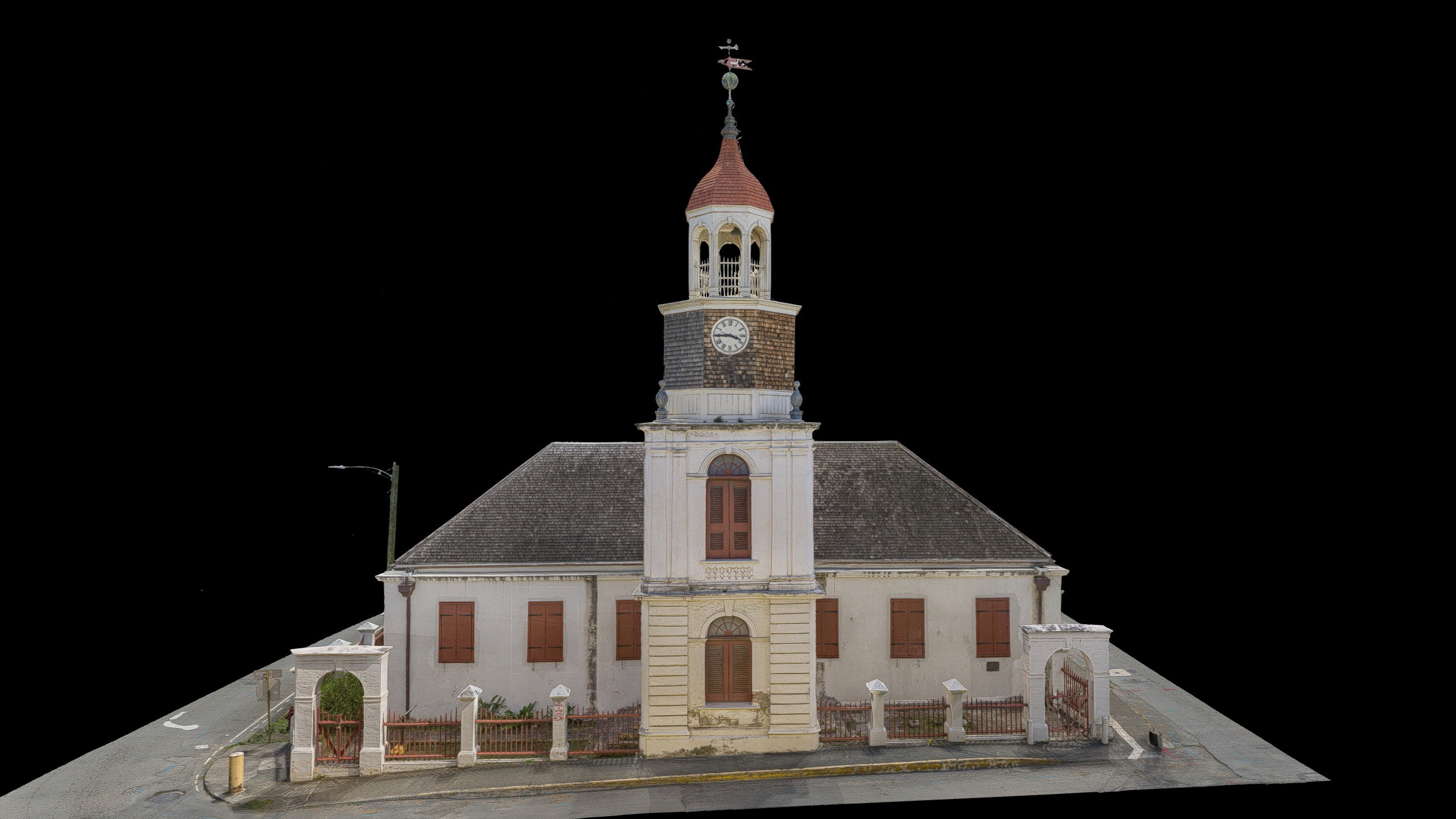
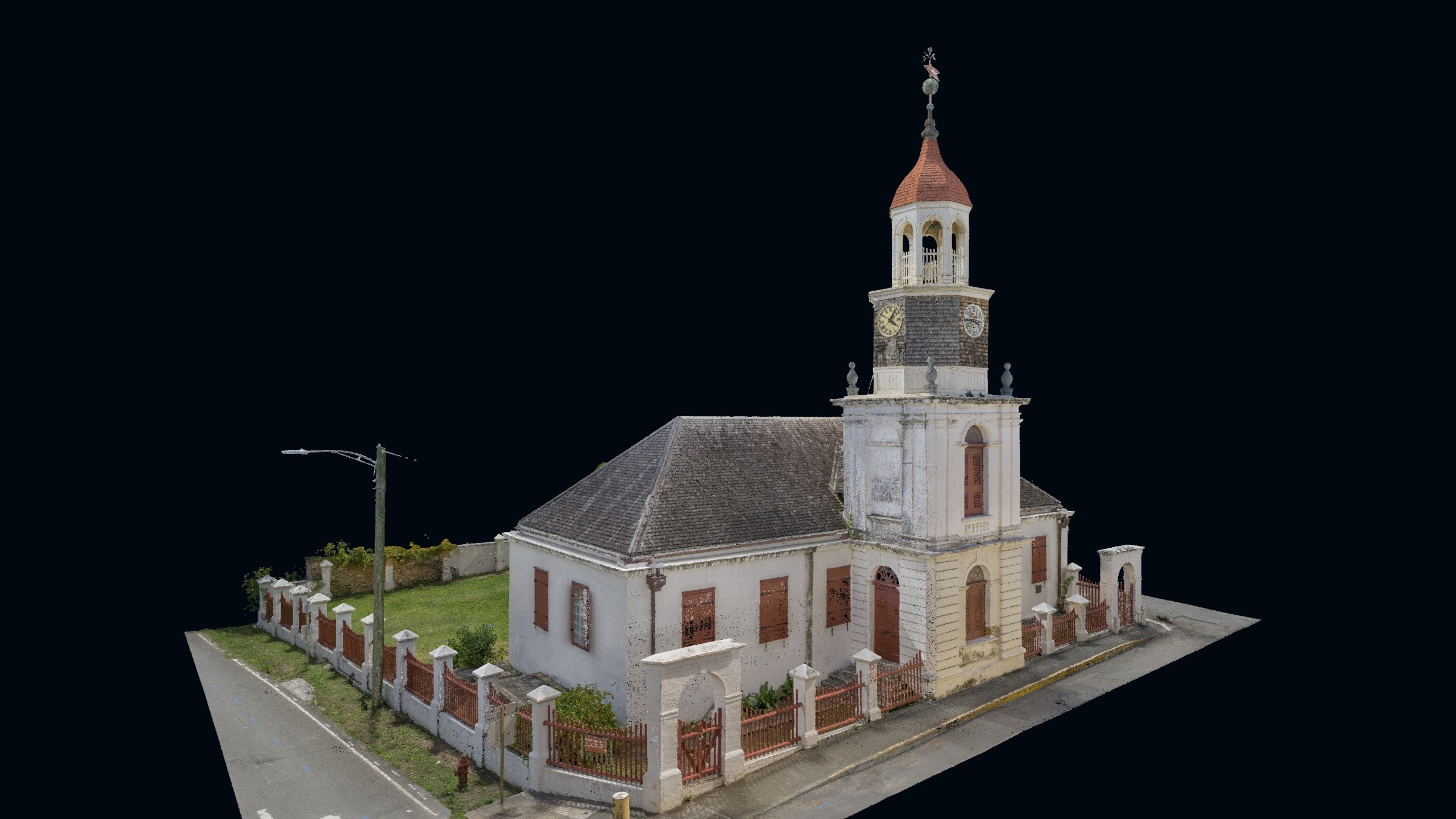
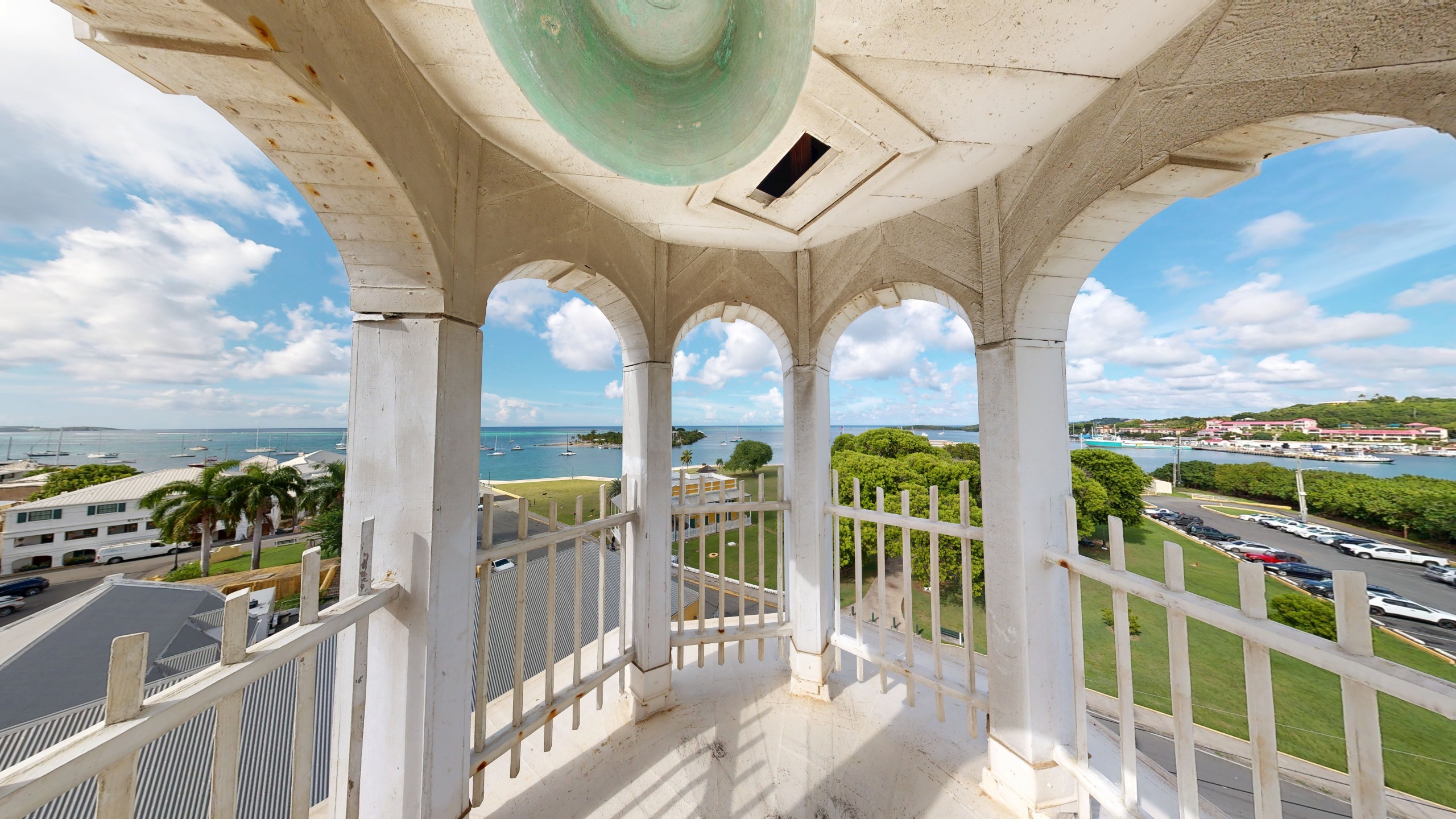
A civic anchor in Christiansted since 1753, the Steeple Building began as St. Croix's first Lutheran church and has since served as a military bakery, town hall, hospital, school, and public museum. Part of the Christiansted National Historic Site, the approximately 5,500-square-foot masonry landmark and its four-tier steeple tower define the town's waterfront skyline. DHM Design, under an NPS contract, hired RC Monkeys to deliver laser scanning, a 3D virtual tour, and photogrammetry that gave the full design team a shared record of the building before anyone set foot on site.
[ SERVICES ]
Laser Scanning
3D Virtual Tour
Photogrammetry
[ delivered value ]
Remote site access before the first visit to St. Croix
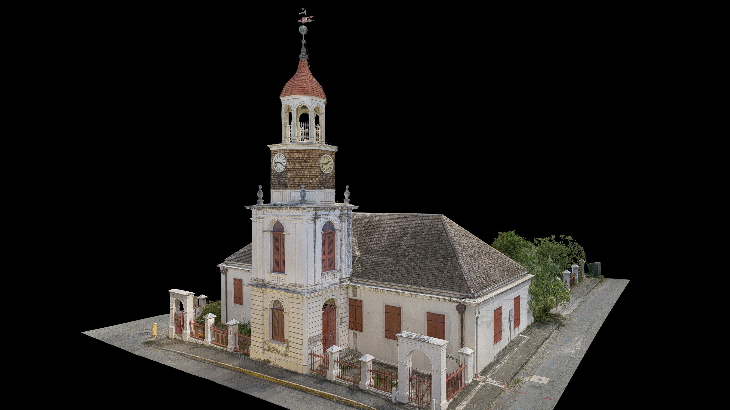
Full coverage of all accessible spaces, including attics and steeple
Shared dataset supporting architectural design and structural assessment
Visual documentation for defect identification and repair planning
±1/8" measured accuracy, exceeding the ±3/8" specification
[ challenge ]
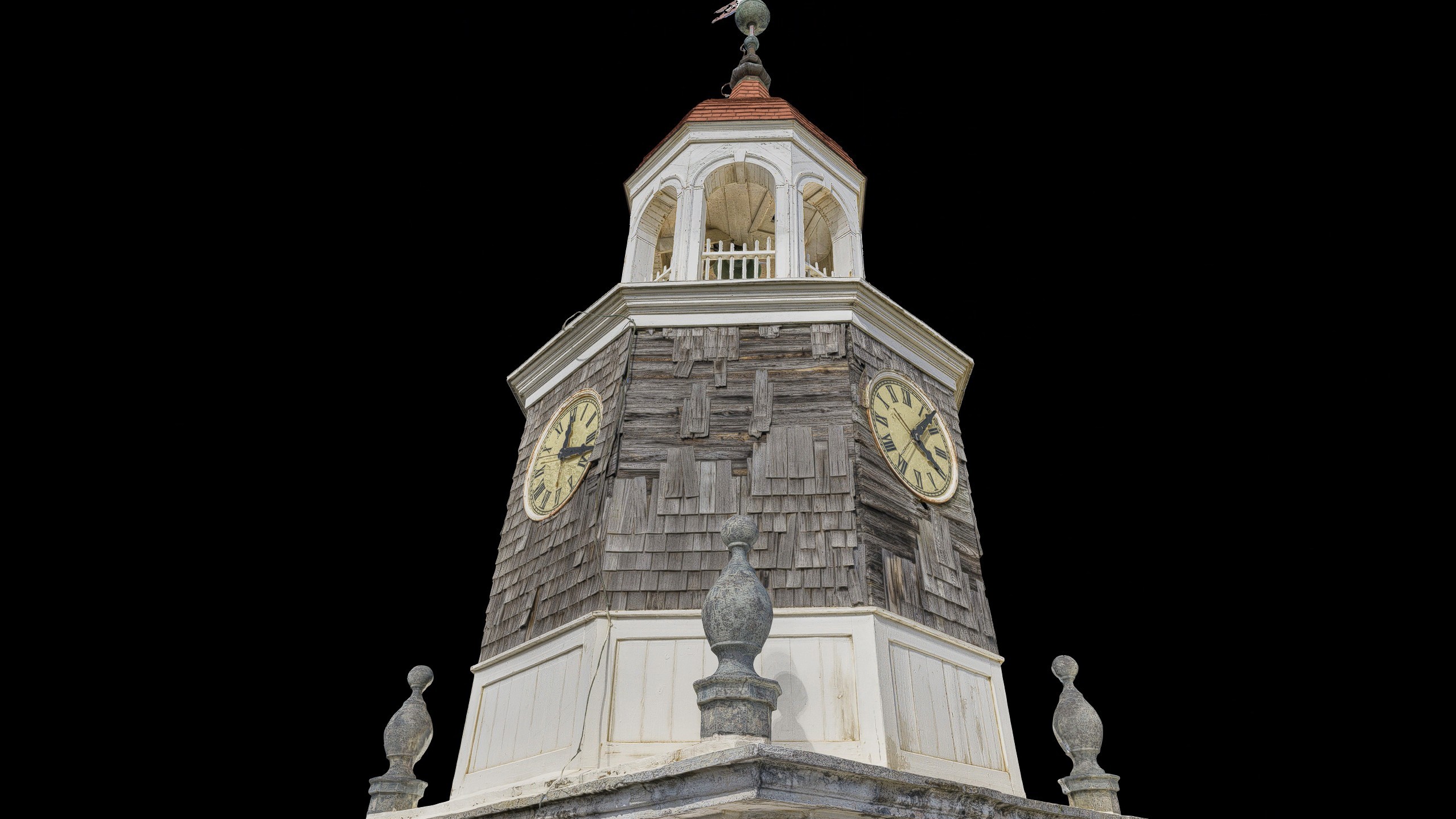
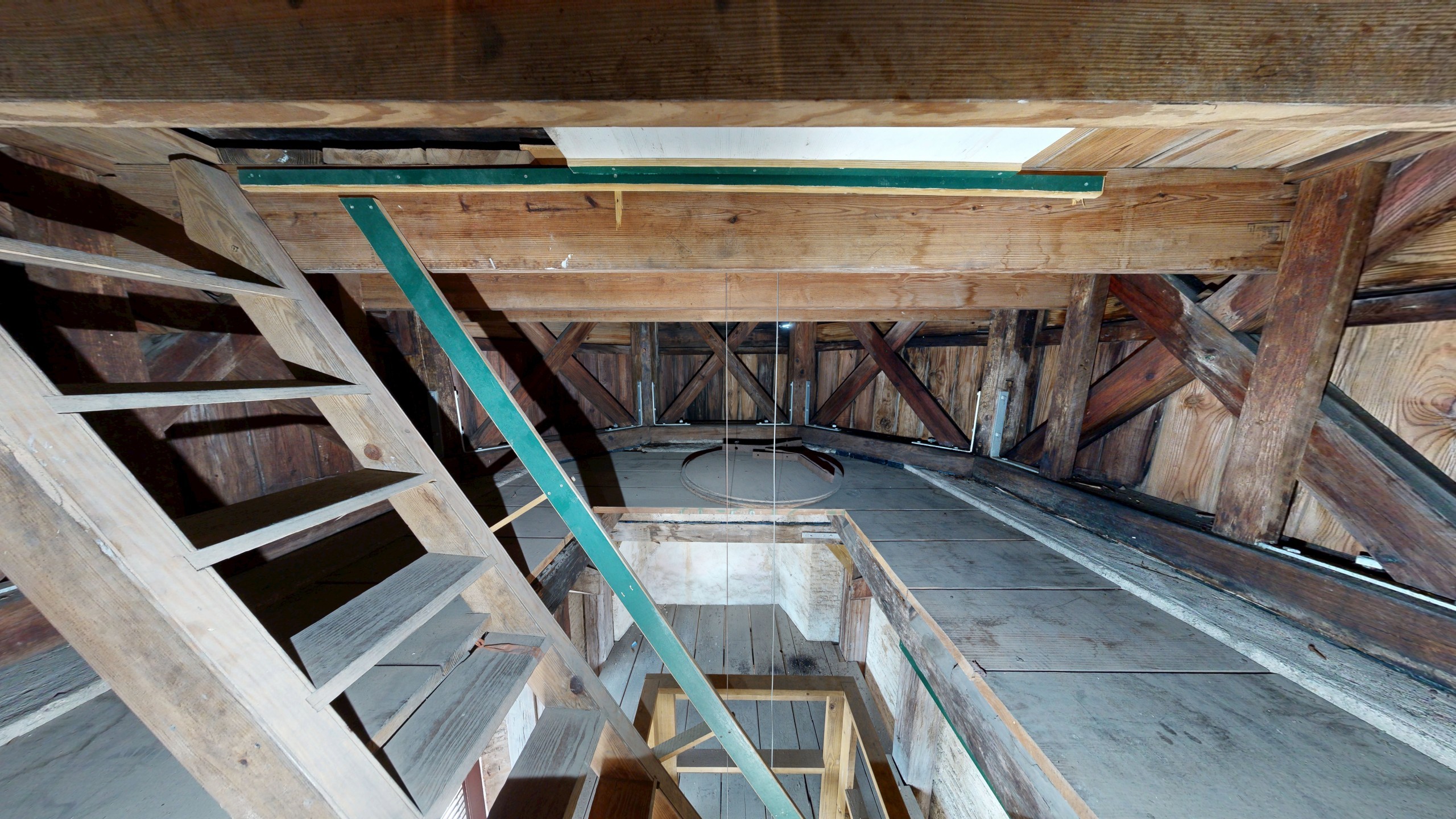
The preservation scope includes structural repairs to the steeple tower, masonry and plaster restoration, roof replacement, life safety upgrades, and tower clock reinstallation. Termite-damaged wood elements and moisture exposure had accelerated deterioration throughout the structure. The building's location on St. Croix made site visits costly and difficult to schedule from the continental US, and mobilizing a full equipment set to the island added logistical complexity to the capture. The design team needed documentation to support condition assessment, structural analysis, and design development, covering every accessible space from the ground floor to the top of the cupola.
[ SOLUTION ]
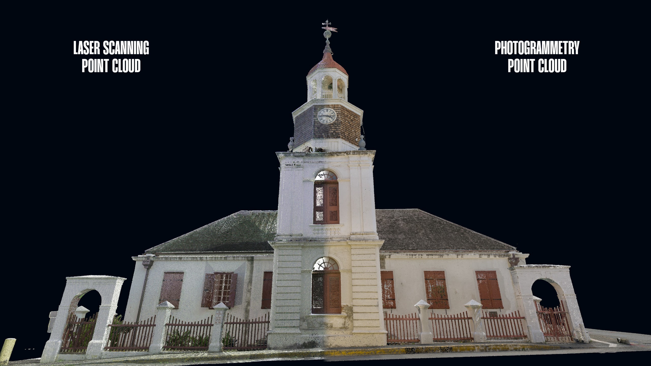
With one mobilization to St. Croix, every capture decision was made to maximize coverage and accuracy from the start.
Laser scanning provided the dimensional baseline the design team needed for measurements. A 3D virtual tour with 360 ° and detailed photography gave every stakeholder an intuitive, web-accessible way to assess conditions without interpreting point clouds. Photogrammetry extended coverage to areas where scanning and photography had limited access or line of sight. This solution produced a photorealistic, web-hosted mesh model with georeferenced inspection photos, a colorized exterior point cloud, and ortho-projected images usable as documentation backgrounds.
RC Monkeys was the first team on-site. Inside the steeple tower, the team worked through multi-tiered, congested access to capture every level from the base to the cupola. The three capture methods gave DHM Design and its consultants full coverage of all accessible spaces, including the sanctuary and cupola attics. All terrestrial laser scanning and photogrammetry outputs were tied to survey control, achieving measured accuracy of ±1/8", exceeding the specified ±3/8".
Under DHM Design's coordination, the documentation served every discipline on the project team. Liollio, the architect of record, used the point clouds to validate existing drawings and develop the Revit model. The structural engineer used the same data to assess deflection and out-of-plumb conditions.
The full documentation package was delivered in 14 calendar days, including travel and capture.
Explore Photogrammetry Model
Next